STATION NAME AND OWNER
The Pallas-Sodankylä station consists of clean air research station in Pallas and ArcticDefinitions of the Arctic vary according to environmental, geographical, political, cultural and scientific perspectives. Some scientists define the Arctic as areas having a high latitude, long winters, short, cool summers,... More Space Centre in Sodankylä. The distance between the two sites is 125 km. Both of these units are hosted and owned by Finnish Meteorological Institute.
LOCATION
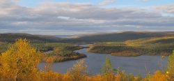
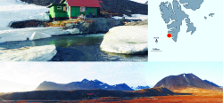
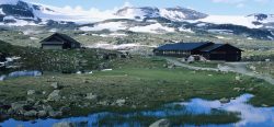
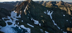
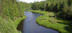
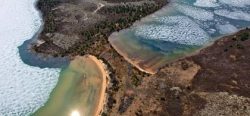
Pallas is located in western Lapland (67°58’ N, 24°07’ E) in Pallas fell. The station is part of the national park, with limited access. Sodankylä facility (67°22’ N, 26°39’ E) is located in centre Lapland, within borealNorthern, from Boreas, the Greek god of the north wind.... More forest region. The station is not part of any national park, but the surrounding area of the station (Ca. 2 km2) is dedicated to the atmospheric and geologyThe study of the solid Earth, rocks and processes by which rocks form. 'Geo' is derived from the Greek word for Earth.... More research, therefore limited access. Furthermore, the area is surrounded with forest area and swamp areas owned by Finnish government. The dominant area type is borealNorthern, from Boreas, the Greek god of the north wind.... More forest.
BIODIVERSITY AND NATURAL ENVIRONMENT
Pallas station consists of research station in Pallas fell. Surrounding national park may be used with restrictions. The area is borealNorthern, from Boreas, the Greek god of the north wind.... More forest, with (deserted) fell area animals and vegetation. Willow grouse, rabbit and reindeer are the most typical animals. Sodankylä station is located in the river bank, in the middle of borealNorthern, from Boreas, the Greek god of the north wind.... More forest. Area is limited to large swamp area. The dominant area type is borealNorthern, from Boreas, the Greek god of the north wind.... More forest, with forest animals and vegetation. Black grouse, rabbit and reindeer are the most typical animals.
HISTORY AND FACILITIES
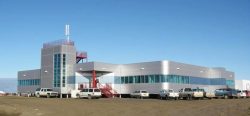
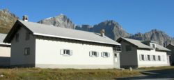
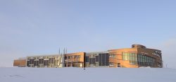
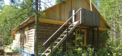
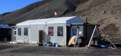
The Finnish Global Atmosphere Watch (GAW) station Pallas-Sodankylä has been operating since 1994. The Sodankylä station was established in 1949, but there are records of continuous homogenized synoptic weather records from 1908 onwards from the site. Furthermore, the first thermo-/barometer based records are from 1856 and there was also temporary met station during the 1st IGY 1882/83. Since 1949 there has been permanent activities hosted by FMI. The facility now consist of multiple buildings altogether containing 1500 m2 space, with supporting mast field in the forest and swamp field, and multiple areal measurement camps.
GENERAL RESEARCH AND DATABASES
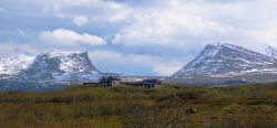
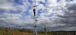
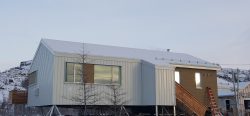
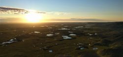
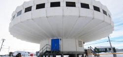
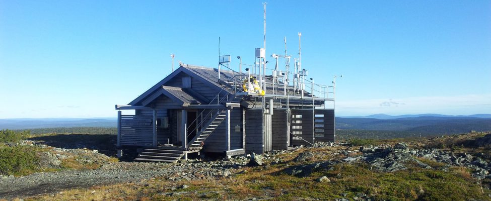
Pallas station consists of research station in Pallas fell. Surrounding national park may be used with restrictions. There are five measuring stations at the Pallas area: an automatic weather stations (AWS), Laukukero (68°04’N, 24°02’E, 765 m above sea level), and four stations measuring air composition. The main station, Sammaltunturi (67°58’N, 24°07’E, WMO index number 05821), is on a top of a fjeld (an ArcticDefinitions of the Arctic vary according to environmental, geographical, political, cultural and scientific perspectives. Some scientists define the Arctic as areas having a high latitude, long winters, short, cool summers,... More hill), at the height of 565 m above sea level (a.s.l.), and ca. 300 m above the surrounding area. Matorova (68°00’N, 24°14’E) lies about six kilometres from Sammaltunturi at of 340 m a.s.l. Kenttärova station (67°59’N, 24°15’E, 347 m a.s.l.) is situated 1.4 km south of the Matorova station. It lies with spruce forest, and is used to measure greenhouse gasA gas found in the earth's atmosphere that traps heat radiated from the surface of the earth, and causes the earth's temperature to rise. The term comes from the fact... More fluxes. The newest station, Lompolojänkä (68°00’N, 24°13’E, 269 m a.s.l.), is measuring green house gas fluxes in an aapa mire. The Laukukero and Sammaltunturi stations are within the Pallas-Yllästunturi National Park, inside the northern borealNorthern, from Boreas, the Greek god of the north wind.... More forest zone. The Sodankylä facility hosts programs exploring upper-air chemistryThe study of matter at the atomic and molecular scale.... More and physics, atmospheric column measurements, snow/soil hydrologyThe study of water in the environment, particularly its amount, movement and quality. It encompasses water in rivers, lakes, glaciers, soil and underground aquifers. The way in which water (liquid and... More, biosphere-atmosphere interaction and satellite calibration-validation studies. Due to the warming effect of the Gulf Stream the area is included in the borealNorthern, from Boreas, the Greek god of the north wind.... More region. However, with regard to stratospheric meteorologyThe scientific study of the atmosphere and its phenomena, especially in relation to weather and weather forecasting.... More, Sodankylä can be classified as an ArcticDefinitions of the Arctic vary according to environmental, geographical, political, cultural and scientific perspectives. Some scientists define the Arctic as areas having a high latitude, long winters, short, cool summers,... More site, often lying beneath the middle or the edge of the stratospheric polar vortex and in the zone of polar stratospheric ozone depletion. Its strategic location, coupled with ready accessibility from all parts of the world, makes the ArcticDefinitions of the Arctic vary according to environmental, geographical, political, cultural and scientific perspectives. Some scientists define the Arctic as areas having a high latitude, long winters, short, cool summers,... More Space Centre an excellent base for studying various themes of global change in a northern context. The ArcticDefinitions of the Arctic vary according to environmental, geographical, political, cultural and scientific perspectives. Some scientists define the Arctic as areas having a high latitude, long winters, short, cool summers,... More Space Centre research sites belong to the Lapland Biosphere-Atmosphere Facility (LAP-BIAT), an infrastructure project through which the EU can fund visiting research groups. Sodankylä station consists of main research area within the station, equipped for atmospheric research. The tower field contains two research masts (48m and 30m) and three towers (5m, 8m and 24m), with supporting borealNorthern, from Boreas, the Greek god of the north wind.... More forest ground measurements. The swamp area measurement field contain 5m tower and supporting ground measurements.
HUMAN DIMENSION
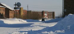
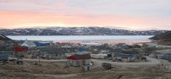
Nearest village Sodankylä in 7 km distance. Sodankylä has around 6000 habitants in the center and around 8500 habitants in the municipality. Main livelihoods contain military forces, mining industry, small industry, agriculture and reindeer farming and few research institutes.
ACCESS
Distance to nearest village (Sodankylä) 7 km, containing bus station. Distance to nearest airport and railway station (Rovaniemi) 130 km. Helicopter station is located in 4 km distance. Travel time from the airport typically less than 2 hours.