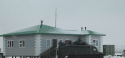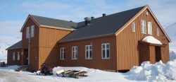
Contact Details
C/ de la Riba, 1
25595 Llavorsí
Catalonia (Spain)
STATION NAME AND OWNER
The Alt Pirineu Natural Park is a governmental institution owned by the Catalan Government (Generalitat de Catalunya) The ownership of the lands included in the Alt Pirineu Natural Park is mainly held by Public Law organisations, for the most part Town Councils and Entitats Municipals Descentralitzades (DME-Decentralized Municipal Entities), who are the owners of communal forests (62% of the area). 36.2 % Communal Town Councils. 25,314 ha 36.0 % Communal DME. 26,293 ha 14.8 % Large Privately Owned States. 10,324 ha 9.3 % Catalan Government Generalitat de Catalunya. 6,485 ha 3.1 % Smaller Privately Owned States (smallholding). 2,148 ha 0.6 % State Government (CHE and DPH). 405 ha The legal owner of communal forests is the state body, but the right of exploitation of its natural resources relies on the neighbour communal body of a village (or villages) to which each forest belongs. Private ownership of the Park is shared among a few, large privately owned areas (named “private societies”, as could be the mountain in Tor or the states Ison-Estallo and Boavi-Broate), and the traditional smallholding ones at the foot of valleys and lower slopes of the Pyrenean mountains. Finally, the Generalitat de Catalunya is the titleholder of some forestry grounds mostly found along the core area of the river Noguera Pallaresa.
LOCATION
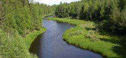
It is located in the axial Catalan Pyrenees, between the Val d’Aran on the west, the Principat of Andorra on the east. Geographically, this protected area vaguely remind us of a crescent moon, slightly irregular and with its southern vertex in the Sanctuary of Arboló, near Gerri de la Sal almost reaching the Pre Pyrenees, and the northern vertex in Bonaigua mountain pass. The Park is integrated within the Parc Pirinenc de les Tres Nacions, which unifies the protected area of the Alt Pirineu Natural Park in Catalonia with the neighbouring protected areas in Southern France (PNR Pyrénées Ariégeoises) and Andorra (Comapedrosa NaturalPark and Sorteny Valley Natural Park) as one whole protected unit.
BIODIVERSITY AND NATURAL ENVIRONMENT
Biogeographical values
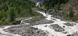
Like other Alpine mountains in Europe, the Pyrenees include small islands of cold biomes, that host the corresponding biotaIn simple terms, this word is a collective term for all living things. To refer only to animals, we use the word fauna, and for plants, flora. See also 'biodiversity'.... More forged across Europe during the Quaternary shifting conditions. In this mountain range the contrast with massive Mediterranean conditions towards the South gives a particular relevance and uniqueness to these ecosystems and species, which persist at high elevations, and share many species of floraThe plants that live in a particular region, habitat or time (such as geological period like the jurassic). For animals, we use the term fauna, and to collectively refer to all... More and faunaThe animals that live in a particular region, habitat or time (such as geological period like the jurassic). For plants, we use the term flora, and to collectively refer to all... More that are found in northern latitudes. In the Pyrenees we often find species at their southernmost distribution edge, so they are very sensitive to environmental changes. The steep physiography, causing strong fragmentation and miniaturization of landscape units, together with changing environmental conditions (i.e., climate changeAccording to the United Nations Framework Convention on Climate Change, climate change is change in the climate of the whole Earth or a region of the Earth that is believed... More), though, puts the Pyrenean alpine biodiversityBiological diversity. The many and varied forms of life on Earth (collectively known as biota). As well as diversity of species (species diversity), there is also diversity within populations of a... More in a critical situation. Current and recent studies on Pyrenean vegetation focus on its response to environmental change, and mirror those from circumpolar areas, although the responses often occur at different scales or at sharper gradients. Examples of homologous vegetation units appropriate for comparative analyses with ArcticDefinitions of the Arctic vary according to environmental, geographical, political, cultural and scientific perspectives. Some scientists define the Arctic as areas having a high latitude, long winters, short, cool summers,... More sites are snowbed Salix herbaceaunits, Vaccinium spp. or Dryas octopetala carpets, limnogenous Carex spp. fens, or cryophilous grasslands. Even where plant species differ between the Pyrenees and high latitudes, vegetation structure and ecosystemAll the living organisms (including people) in an area as well as its physical environment, functioning together as a unit. An ecosystem is made up of plants, animals, microorganisms, soil,... More processes offer unique opportunities for broad scale studies, e.g. altitudinal vs. latitudinal gradients; comparative shrubline or treeline dynamics.
Geological Values
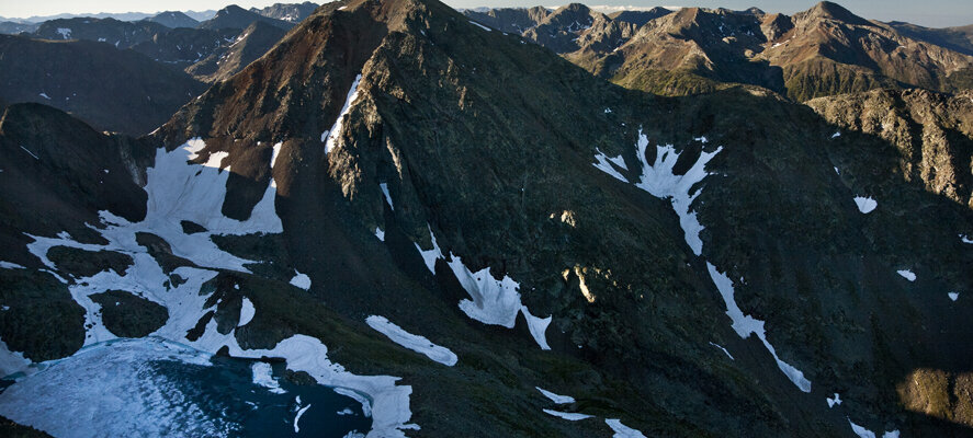
- Glacial genesis geomorphology on Cambrian-Ordovician and Devonians rocks (schist, granites and carbonated rocks), quartz outcrops and volcanic origin rocks, U-shaped valleys, glacial-erosion cirques, glacial overdeepening basins, Late Glacial rocky deposit, Rock glaciers
- 6 inventory zones of the Espais d’Interès Geologic de Catalunya (Areas of Geologic Interest in Catalonia) as geotopes or geozones
- 87 lakes, among them the largest lake in the Northern Pyrenees (Certascan), and 94 ponds Botanical Values
- 1.590 species of vascular plant floraThe plants that live in a particular region, habitat or time (such as geological period like the jurassic). For animals, we use the term fauna, and to collectively refer to all... More (preliminary catalogue)
- 22 species of threatened or very rare floraThe plants that live in a particular region, habitat or time (such as geological period like the jurassic). For animals, we use the term fauna, and to collectively refer to all... More in Catalonia, as Cerinthe glabra, Hippuris vulgaris, Juniperus thurifera, Salix hastata, Matthiola valesiaca or Astragalus penduliflorus FaunaThe animals that live in a particular region, habitat or time (such as geological period like the jurassic). For plants, we use the term flora, and to collectively refer to all... More Values
- 29 Odonata species, 3 of which are vulnerable according to IUCN-International Union for Conservation of Nature and Natural Resources • 268 vertebrate species catalogued up to date
- Endangered or rare species such as the brown bear, the otter, the Pyrenean desman, the bearded vulture, the black vulture, the Egyptian Vulture, the red kite, the capercaillie, the rock ptarmigan, the grey partridge, the Tengmalm’s owl, the Eurasian woodcock, the wallcreeper, the white-winged snow finch and the Pyrenean brook newt
- Parks’ almost exclusively endemic: Pallaresan rock lizard
- Largest population of capercaillie in the whole state (150 male census) Habitats
- 6 priority habitats of common interest, among which the only formations of Spanish juniper in Catalonia
- 30 non-priority habitats of common interest
- Some high mountain lakes and ponds not disturbed by hydroelectric infrastructures or fish introduction. Important representation of wetlands and bogs (118 wetlands adding up to 275 ha)
- Extensive and well-preserved woodlands consisting of mountain pine, Scots pine and silver fir, including certain sectors with a high degree of maturity. Isolated nucleus of beech forests. Check this link for further information: https://parcsnaturals.gencat.cat/en/xarxa-de-parcs/alt-pirineu/el-parc/patrimoni-natural-i-cultural/
HISTORY AND FACILITIES
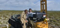
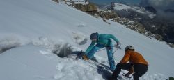
The Alt Pirineu Park Natural (PNAP) was established as such on a decree on the 1 August 2003 (Decret 194/2003), after a process of negotiation that took place between the years 2001 and 2003. Yet, the need to protect certain areas that today are part of the Park became clearer much before in time, as explained below. In 1932, the Regional Planning (the first intention to have a comprehensive planning of the Catalan territories) proposed a network of protected areas; within these areas, there was an attempt to include those in Sant Joan de l’Erm, the valley of Santa Magdalena, the woodlands in Soriguera and other adjacent sectors. In 1966, a law was passed to create the Alt Pallars-Aran National Hunting Reserve; the extent of the reserve comprises a considerable part of the grounds in the Alt Pirineu Natural Park. However, the first legal consideration as a protected area came through the Pla d’Espais d’Interès Natural (PEIN) –literally, plan for Areas of Natural Interest-, passed by the Catalan Government, la Generalitat, with a decree, the Decret 328/1992, on 14 December. Most of the park is constituted by three areas included in the PEIN: Alt Àneu, Headwaters of both Noguera rivers, of Vallferrera and of Cardós, and Vall de Santa Magdalena. Furthermore, in November 2001, the Catalan Government, la Generalitat, regarding the alpine biogeographical region, approved the Catalan proposal of natural areas to be included in Natura 2000, the EU protected areas network. There, the PEIN areas above mentioned were taken into consideration, on top of the Alt Pallars area and also la Torrassa. In 2018 there was an enlargement of the surface of Alt Pirineu Natural Park up to 79.317 hectares. In 2021 the Research Observatory of the Alt Pirineu Natural Park was inaugurated to promote research in the area and to transfer knowledge amongst the scientific community, the managing team and society.
HUMAN DIMENSION
All the populated villages and hamlets are out of the Park boundaries. According to the data from 2019, there are 8.065 habitants in the area of influence consisting of 15 municipalities, which contribute to the Park with their territories.
Cultural Values:
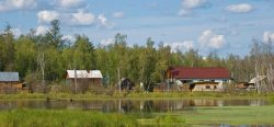
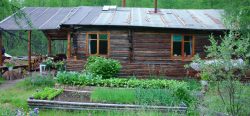
- Extensive cultural material heritage, especially popular architecture and Romanesque art; and immaterial heritage, related to the traditional uses of the territory and that of the local people
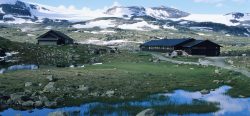
- Important presence of mountain sheds, hovels and grasslands linked to the historical models of extensive livestock breeding of the Park’s pastures
- Industrial rural heritage: hydropower sawmills, millstones, forges, hydroelectric infrastructures, etc.
- Sites and places of spiritual local signification such as sanctuaries or hermitages, and plenty of spots for the celebration of popular gatherings
- Very few singular elements showing the relationship between human kind and the natural environment, such as wolf traps.
ACCESS
There are several options to get to the Park, whether it is using public transport or a private vehicle (it takes about 3,30h by private car from Barcelona to the Park). However, the limited coverage of public transport must be taken into account, since currently it only covers the access with a regular service to the most important villages within the Park boundaries. Access to the Park grounds implies driving along non-paved mountain roads or forest rides, thus, if driving private cars, those with a higher chassis are preferred; consider hiring a four-wheel drive local taxi. Once in the Park, access on foot or mountain bike is recommended, making the best of the extensive network of paths, which often have their staring point in the nearby villages.